Services > Land Surveying
Surveying
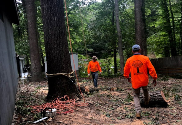
Nottingham Landmark Assessments delivers comprehensive surveying solutions across the East Midlands, combining cutting-edge technology with local expertise to provide accurate, actionable insights. Our RICS-accredited surveyors specialise in building surveys, topographic mapping, and flood risk assessments, tailored to the region’s unique challenges—from Nottingham’s urban regeneration sites to Northamptonshire’s clay-soil suburbs. Using advanced tools like 3D laser scanning and drone photogrammetry, we identify structural defects, boundary discrepancies, and hidden risks, empowering homeowners, developers, and councils to make informed decisions.
Whether you’re purchasing a period property in Lincolnshire, planning a commercial development in Derby, or managing public infrastructure in Leicestershire, our surveys provide the clarity needed to mitigate risks and optimise investments. From mining subsidence checks in ex-colliery towns to thermal efficiency assessments for eco-homes, we bridge the gap between construction standards and real-world conditions—ensuring your project is built on certainty, not guesswork.

Land Surveyor
Nottingham Landmark Assessments provides comprehensive land surveying to support construction, development, and legal boundary needs. Our certified surveyors use GPS, LiDAR, and drone technology to deliver precise measurements for topographic mapping, boundary demarcation, and elevation analysis. Whether you're East Midlands and planning a residential development, infrastructure project, or land subdivision, our surveys ensure accuracy from the outset—preventing costly disputes and design errors.
We specialise in detailed site analysis, identifying potential challenges like grading issues, drainage concerns, or hidden obstructions before construction begins. Our reports comply with UK surveying standards, providing reliable data for architects, engineers, and planners. From initial feasibility studies to as-built verification, we help clients navigate every stage of land development with confidence.

Land Measurement
Did you know that accurate land measurement forms the foundation of any successful development, construction, or legal boundary project? Our expert surveyors utilize state-of-the-art GPS, total stations, and drone technology to deliver precise dimensional data for plots of all sizes and complexities. Whether you require boundary line verification, topographic surveys, or subdivision measurements, we provide legally compliant documentation with millimeter-level accuracy to prevent disputes and ensure regulatory compliance.
We specialize in both pre-construction measurements to inform design work and as-built verification to confirm project adherence to plans. Our detailed reports include area calculations, elevation data, and terrain modeling, giving developers, architects, and landowners the critical information needed for informed decision-making. From small residential plots to large-scale commercial sites, our measurement services remove guesswork from your project's foundation.
Services > Land Surveying

Land Surveying
At Brighton and Hove Landmark Assessments, we specialize in land surveying—a precise science essential for defining the terrestrial positions, boundaries, and topography that underpin safe and legally sound property development.
Land surveying is far more than just measuring distances; it involves determining the two-dimensional and three-dimensional positions of points on the Earth’s surface, establishing accurate maps, and resolving boundary ambiguities that could lead to disputes or costly errors. In Brighton and Hove, where historic properties, coastal terrain, and modern developments intersect, overlooked boundaries or inaccurate terrain data can jeopardize construction projects, property sales, or compliance with local regulations.
Land Surveyor
Our RICS-accredited surveyors combine cutting-edge technology—such as 3D laser scanning, GPS, and drone mapping—with decades of expertise to deliver meticulous boundary delineation, elevation mapping, and subsurface feature analysis.
Whether you’re planning a new build, resolving a land dispute, or restoring a heritage site, we ensure every measurement aligns with UK legal standards and environmental requirements. By partnering with us, you gain clarity on your land’s true potential, avoid legal pitfalls, and lay a foundation for projects built on precision.

Land Measurement
Land measurement serves as the backbone of informed decision-making in property development, offering precise spatial data that defines everything from plot dimensions to elevation gradients. In areas where historical preservation and modern development intersect, techniques like LiDAR scanning and theodolite angle measurement capture intricate details of the land’s contours and features. This data is vital for applications such as boundary demarcation in heritage sites or ensuring land registry compliance for eco-friendly developments.
Beyond resolving ownership disputes, accurate measurement supports sustainable urban planning—whether balancing flood resilience in vulnerable zones or optimizing green spaces in densely populated areas. At Brighton and Hove Landmark Assessments, we blend traditional tools with satellite-based geospatial systems to deliver insights that drive compliant, cost-effective projects. From residential extensions to large-scale infrastructure, our surveys transform raw terrain data into actionable strategies, ensuring every development aligns with regulatory standards and your vision.


GPS Land Surveying
GPS surveying has revolutionized the land surveying industry by enabling rapid, high-precision measurements of terrestrial positions, boundaries, and elevations. Using satellite-based Global Positioning Systems (GPS), surveyors can pinpoint locations with centimeter-level accuracy, even in challenging environments like dense urban centers or undulating rural landscapes. Unlike traditional methods, GPS technology eliminates the need for labor-intensive line-of-sight measurements, streamlining tasks such as boundary demarcation, topographic mapping, and construction site layouts.
Real-Time Kinematic (RTK) GPS systems further enhance efficiency by delivering instant data corrections, ensuring reliability for projects ranging from resolving property disputes to planning sustainable infrastructure. This blend of speed and precision makes GPS surveying indispensable for modern developments, where tight timelines and regulatory compliance demand flawless data.
Distance Measurement
Long before the advent of electronic tools, land surveyors relied on ingenious yet labor-intensive methods to measure distances. Indigenous peoples in pre-colonial America, for example, used the "bow shot" — the distance an arrow could travel — as a rough unit of measurement. In Europe, surveyors employed steel chains like the Gunter’s chain or invar tapes, meticulously pulling them taut to minimize sagging and adjusting for heat expansion to maintain accuracy.
Measuring slopes required "breaking" chains into smaller increments, while perambulators (measuring wheels) provided rough estimates for longer distances over uneven terrain. For particularly challenging landscapes, tacheometry offered a workaround by calculating distances through angular measurements of objects with known sizes. Though innovative for their time, these methods were prone to human error, environmental interference, and inefficiency, making tasks like mapping Brighton’s undulating South Downs or resolving boundary disputes in Hove’s historic districts painstakingly slow.
Today, Brighton and Hove Landmark Assessments leverages cutting-edge Electronic Distance Measurement (EDM) and laser technology to deliver unparalleled precision in land surveys. Modern EDM devices use lasers or infrared waves to measure distances instantaneously, eliminating the need for manual chains or angular calculations. This technology captures millimeter-level accuracy, even across Brighton’s coastal slopes or dense urban areas, while automatically compensating for environmental factors like temperature. Combined with GPS and 3D mapping tools, EDM streamlines tasks such as boundary demarcation in Rottingdean, topographic surveys for flood-prone zones in Pevensey, or construction layouts in Kemp Town’s heritage sites.
Need to get in touch?
Chartered Surveyor Services in East Midlands
Free Estimate In 3 Easy Steps

Request a Free Quote
Request a free estimate by either calling our friendly dispatch center, open 24 hours at 7871516899, or complete our short quote request form to have one of our estimators contact you to schedule a time to survey the job.
![[keyword]](https://assets.cdn.filesafe.space/NauQpo5pzTJd39PLTSpC/media/9c556208-16c4-488e-8c4a-9ffb0897d6e0.png)
Receive a Written Estimate
After the job is surveyed, you will receive a written estimate via text outlining the job details and the cost. Just reply back with your acceptance and we'll contact you to schedule the job to be completed when it is convenient for you.
![[keyword]](https://assets.cdn.filesafe.space/NauQpo5pzTJd39PLTSpC/media/91229cef-c96e-4643-aaba-690e87d107bc.png)
Get Your Land Survey Done!
Our crew of professionals will show up on the scheduled date and time to complete your job, cleanup the debris, and leave your yard looking better than ever!
Free Estimate
In 3 Easy Steps
Request a Free Quote
Request a free estimate by either calling our friendly dispatch center, open 24 hours at 7871516899, or complete our short quote request form to have one of our estimators contact you to schedule a time to survey the job.
![[keyword]](https://assets.cdn.filesafe.space/NauQpo5pzTJd39PLTSpC/media/972872b1-3dca-4a8e-950a-5740552ed211.png)
Receive a Written Estimate
After the job is surveyed, you will receive a written estimate via text outlining the job details and the cost. Just reply back with your acceptance and we'll contact you to schedule the job to be completed when it is convenient for you.
![[keyword]](https://assets.cdn.filesafe.space/NauQpo5pzTJd39PLTSpC/media/7abc41ca-81bc-42de-8b26-2983949d195b.png)
Get Your Survey Done!
Our crew of professionals will show up on the scheduled date and time to complete your job, cleanup the debris, and leave your yard looking better than ever!


GPS Land Surveying
Nottingham Landmark Assessments utilizes advanced GPS surveying technology to deliver highly accurate land measurements for projects across Nottinghamshire and the East Midlands. Our RTK (Real-Time Kinematic) GPS systems provide centimeter-level precision, ideal for boundary surveys, topographic mapping, and construction staking. Unlike traditional methods, GPS surveying allows us to quickly capture data across large or difficult-to-access sites—from open farmland to dense urban areas—while maintaining exceptional accuracy.
This technology is particularly valuable for:
✔Large-scale site surveys where efficiency is critical
✔Precision agriculture planning in rural areas
✔Infrastructure projects requiring exact positioning
✔Boundary disputes needing irrefutable evidence
Key Benefits of Nottingham Landmark Assessments GPS Surveying:
✔ Faster data collection than conventional methods
✔ Superior accuracy in challenging terrain
✔ Seamless integration with GIS and CAD systems
✔ Reduced setup time on site
✔ Comprehensive data for planning applications
Typical Applications of Our GPS Land Surveying:
✔Land parcel measurement and demarcation
✔Construction site establishment
✔Utility mapping and recording
✔Flood risk assessment surveys
✔Monitoring ground movement over time
Distance Measurement
Accurate distance measurement forms the backbone of effective surveying, construction, and land development projects. At Nottingham Landmark Assessments, we utilize state-of-the-art electronic distance measurement (EDM) technology integrated with our total stations and GPS equipment to deliver millimeter-level precision. Our methods surpass traditional tape measures, enabling reliable calculations for boundary demarcations, building layouts, and topographic surveys—even across challenging terrain or large sites. Whether establishing property lines, setting out foundations, or verifying as-built dimensions, our distance measurement services ensure every project begins with trustworthy spatial data.
We specialize in both horizontal and slope distance measurements, applying corrections for environmental factors like temperature and atmospheric pressure when extreme accuracy is required. Our surveyors frequently employ these techniques for:
Construction site setup and structural alignment
Land subdivision and parcel mapping
Dispute resolution involving boundary disagreements
Monitoring structural movement over time
Frequently Asked Questions
How does Nottingham Landmark Assessments ensure survey accuracy?
✔ Use calibrated GPS, total stations, and 3D laser scanners
✔ Apply atmospheric corrections for long-distance measurements
✔ Cross-check data with multiple methods (e.g., GPS + EDM)
✔ Provide RICS-compliant reports with clear documentation
What’s the difference between traditional land surveying and GPS surveying?
Traditional land surveying uses theodolites and tape measures, while GPS surveying employs satellite technology for real-time, centimeter-accurate measurements across large areas. GPS is ideal for open terrain, large sites, or projects requiring georeferenced data, whereas traditional methods may still suit small urban plots with obstructions. Nottingham Landmark Assessments uses both for optimal precision.
Why is millimeter accuracy important in distance measurement?
Millimeter-level precision prevents costly errors in construction layouts, boundary disputes, and engineering projects. Our EDM (Electronic Distance Measurement) tools and GPS RTK systems account for environmental factors, ensuring reliable data for:
✔ Foundation setting
✔ Legal boundary agreements
✔ Structural monitoring
Can surveying help resolve property boundary conflicts?
Yes! Our surveys:
Map exact boundary lines using GPS or traditional measurements
Identify encroachments or discrepancies in deeds
Produce court-admissible evidence for disputes
Recommend solutions (e.g., marker installation, legal mediation)
Contact Us
Service Hours
Social Media
Contact Us
7871516899
Brighton and Hove
Service Hours
Monday - Friday: 9 am to 5 pm
Saturday: 9 am to 4 pm
Sunday: Closed
Social Media


2025 | All Rights Reserved
Privacy Policy | Site Map